Maps

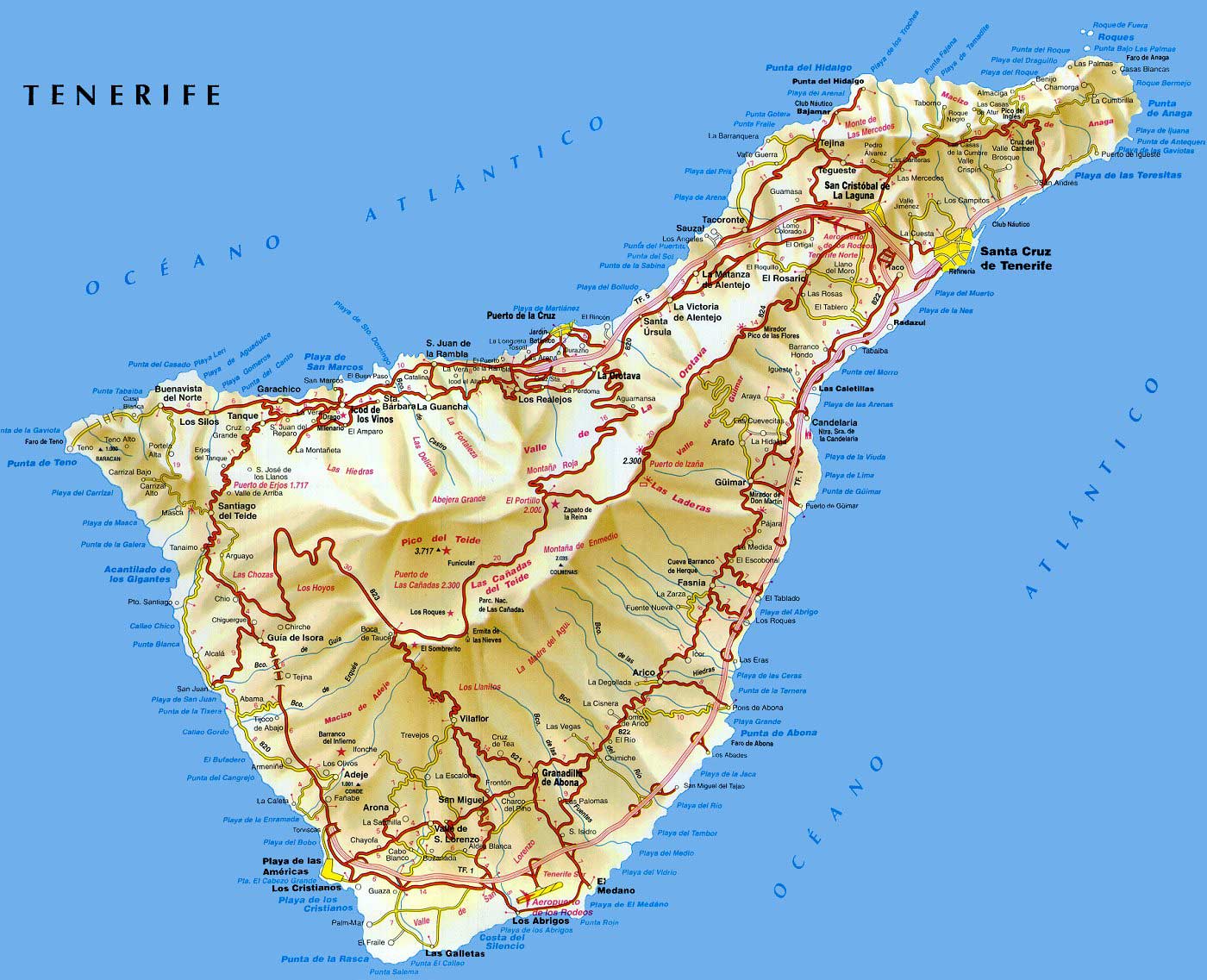
You can easily locate Tenerife North airport (Los Rodeos), Tenerife South airport (Reina Sofia), Teide vulcano, Playa de las Americas, Puerto de la Cruz, Santa Cruz de Tenerife, Los Cristianos. If you want to see the map in full size, just click on the map to make it bigger and printable.

Playa de las Americas map. Click here to see Torviscas village, San Eugenio village, Aquapark and main hotels and residences around Playa de las Americas.

Cristianos map. Click here to see Las Vistas Beach, the port and main hotels and residences) arounf playa de los Cristianos.

Puerto de la Cruz map. Click here to see Lagos Martianez, El Jardin Botanico, Playa Jardín and the main hotels and residences around Puerto de la Cruz city.

Island map. You may want to download a Tenerife full large detailed map available in pdf here.

Municipalities map. Click here to see the island with its geographic division.

Reply to “Maps”

XHTML: You can use these tags: <a href="" title=""> <abbr title=""> <acronym title=""> <b> <blockquote cite=""> <cite> <code> <del datetime=""> <em> <i> <q cite=""> <strike> <strong>

Type & press Enter to Search

Poll

Have you been in Tenerife?
View Results

Weather Forecast

    Thursday, Mar 11
    Mostly Cloudy
    Currently: 66˚F
    Feels Like: 66˚ F
    Hi: N/A˚, Lo: 61˚
    Mostly Cloudy

    Tonight: 61˚
    Sunset: 7:13 PM
    Moon Phase: Waning Crescent
    Showers Early

    Friday, Mar 12
    Hi: 69˚, Lo: 59˚
    Partly Cloudy

    weather feed courtesy of weather.com - thanks!

Social

Add to Technorati Favorites Destinations Blogs - BlogCatalog Blog Directory

Copyright © 2009 TenerifeGuide.com. Powered by Wordpress with Tourist Guide theme by Pedro Dias

Your Guide to visit the Tenerife island - Tourist information for travelers. Includes maps, weather, photos, attraction reviews, restaurants guide told by locals.